The Benefits of a 3D Laser Scanning Survey
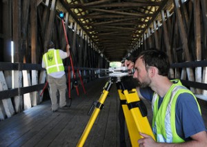 Laser scanning has undeniably revolutionized the field of land surveying. The latest laser scanning technologies enable us to help our clients plan and execute the most efficient projects, and they allow customers to analyze every component of any facility or site. These capabilities help us make better decisions during every step of the project – from the planning stages through completion.
The versatile technology can be applied to a variety of land surveying needs, including change detection, accident reconstruction, 3D drawing creation, pre-project scanning and more.
A 3D Laser Scanning Survey Produces Faster Results, Cuts Field Time
In the past, field surveys could take days or even weeks to complete. Using laser scanning technology, it’s possible for us to complete the same field surveys in just one single day. Laser scanning also enables us to complete fly-throughs, 3D models, detailed animations and maintenance materials in less time than ever before.
A 3D Laser Scanning Survey Reduces Overall Project Costs
The increased speed and accuracy of laser scanning means that our survey team has to complete fewer field visits to collect data. This reduces the overall cost of a project for you.
A 3D Laser Scanning Survey is Highly Accurate
Laser scanning technology produces the most accurate data available. This solid knowledge base helps us help you plan better projects.
A Laser Scanner Survey Is A Versatile Tool
We use laser scanning technologies in many aspects of land surveying. We rely on laser scanning for budgetary and timeline preparation, application implementation, historical preservation, reaching once-impossible areas, change detection, hazard surveying and accident reconstruction. We also use laser scanning to produce detailed topological maps, volumetric calculations, 2D drawings, 3D models and more.
Overall, laser scanning helps us better understand building conditions, and this enables us to make better decisions regarding your projects. To learn more about laser scanner surveying and how it has changed the field of land surveying, contact our team today.
Image By: USACE HQ

