What Are the Limits of Using Drones in Construction?
Drones are very useful tools for any construction project, but they aren’t without some challenges. There are some limitations to the use of drones in construction, as well as potential complications. Using a company that specializes in drone technology can help you navigate some of these challenges.
Drone Regulations Continue to Change
Rapidly changing regulations can make it confusing for people to get the permits they need, especially if aerial scanning has to be completed in urban areas, like construction sites in the midst of large cities. It may even be difficult to even determine which permits need to be acquired.
A company that specializes in drone technology will be able to help a construction company navigate these regulations, especially since said regulations may change given the relative newness of drone technology. Changing regulations and permitting processes may occasionally delay a project, but these concerns are primarily for those who work in large, urban areas.
For open spaces and rural locations, drone permits generally aren’t as much of a concern.
Optimal Use of a Drone Requires the Services of a Trained Professional
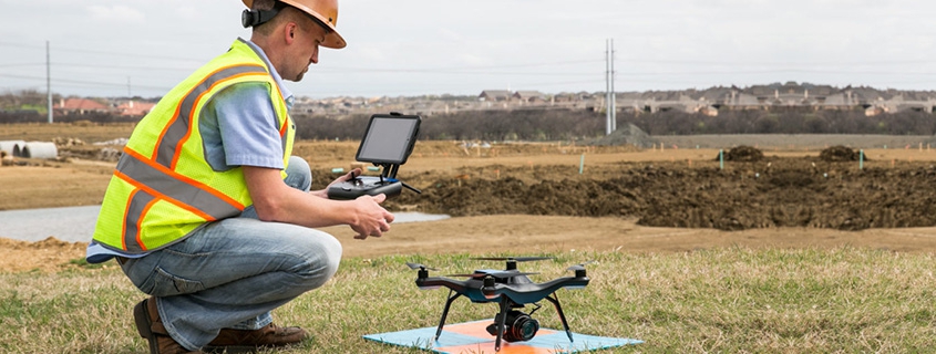
Drone scans shouldn’t be done by just anyone. If a scan isn’t done by a trained professional, the drones can return inaccurate, incomplete, or erratic results. An improperly controlled drone can even cause property damage. Drones take training to be able to fly well, and the aerial surveying and scanning systems require further training and experience. Imagine a world where you need to send a drone out again because the first scan didn’t get all the data it needed to!
Drones Have a Limited Flight Time
Due to their batteries, drones can only fly for a limited amount of time. If a project must be completed urgently but involves covering a large area, multiple drones may need to be used to ensure complete coverage – or a project manager may want to look into other, potentially more suitable, technology.
Drone technology is changing all the time, and as their battery power is extended, the use of drones in construction grows increasingly practical. For most aerial mapping projects, drones will be more than sufficient. Completing regular maintenance scans is a valuable use of drones in construction, and it generally isn’t time dependent.
Drones Don’t Fly Well in High Wind Conditions
While drones are agile and reliable, they can’t deal well with high winds. Drones are lightweight and small; high winds can blow them off course and make it impossible for them to get consistent readings. Luckily, it’s rare that a project is so urgent that an inspection or survey cannot wait until high wind conditions have dispersed.
There are certain locations, however, that may regularly experience high winds, and drones will not be as suitable to those locations. When it comes to high winds, airplanes are often used for aerial scanning, as they can fly over the terrain without much issue. Helicopters are another viable option that can safely fly closer to the ground than airplanes can.
Drones May Require a Specialized Data Pipeline
As advanced technology, drone data often needs to be analyzed through a specialized data flow. While this does limit the use of drone technology to companies with access to advanced analytics services, there are a multitude of reasons why construction managers should be embracing complex data analysis like Building Information Modeling.
The need for a specialized data pipeline can be subverted by partnering with a company that manages and analyzes data in-house. An in-house data processing service will be able to provide surveying data in a way that can be understood and utilized by the client company, like 3D maps or charts.
Though there are some limitations to using drones for aerial mapping and construction, they’re still an incredibly useful and versatile technology. Companies such as Landpoint specialize in using and implementing drone technology, but Landpoint – unlike many other mapping and surveying companies – also provides surveys through other aerial scanning vehicles.
Regardless of their limitations, drones remain a powerful tool in the arsenal of any construction project manager or director. Contact Landpoint today to learn how an aerial survey can make your next project easier.


