Pre-Construction Planning Process: How Land Surveying Services Help
 A construction survey typically consists of determining current site conditions for future above-ground and in-ground infrastructure. Land surveyors stake elevations for footings, collect topographic data for mapping existing drainage courses, invert elevations and diameters of pipe and manholes perform a number of other services. Land surveying services are used to establish the accurate location of proposed structures, accesses, pipelines, buildings, and other improvements.
Most land surveying services are provided by local companies or companies with local offices. They typically have some prior knowledge of the area to be surveyed, including its history, soil& water conditions, sensitive areas, habitats and protected species. This not only reduces the time to get to the designated site, but also provides the client valuable area insight upfront, from which decisions may be made and plans designed.
Land surveying services can include due diligence as well. Land survey teams may inspect buildings for hazardous materials such as asbestos, lead, and PCBs, which must be addressed prior to demolition, new construction or exploratory operations. Land surveyors may also discover other issues such as buried fuel tanks or ground water contaminants.
How Land Surveying Services Help With Pre-Construction Project Planning
A surveying firm adds more value to the pre-construction planning stages of any project. In addition to site analysis, boundary & topographic surveys, maps, and plats, they also:
- Help mitigate the risk of potential future regulatory enforcement actions
- Minimize or eliminate costly delays in project schedules
- Maximize project startup efficiencies through comprehensive regulatory planning
- Provide data which helps define project scope and aids strategic pre-construction planning
3D Scanning for Retrofits
Retrofitting involves modifying existing structures or equipment to reinforce and add structural life to it. Many existing buildings, overpasses, bridges, and towers are being retrofitted to withstand potential seismic shaking and shocks.
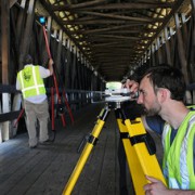
Surveying teams collect data which is used to construct a 3D model of the existing environmental features, structures, and objects. 3D scanning is ideal for analyzing, planning, and designing retrofit projects. The surveying team collects its data points in the field and creates a digital model that depicts height, width, and depth.
3D maps and point clouds show elements and measurements of buildings, utilities, construction and structural objects such as pipe, cable, and plumbing. This is very helpful when an existing building or structure (such as a bridge) is scheduled for retrofitting. Engineering departments find these deliverables invaluable when working on retrofit projects.
Establishing Survey Standards
For any given project there may be more than one surveying company involved. One surveying firm may well establish basic standards in the pre-planning phase for other surveying teams to follow. A responsible and reputable surveying company may set the standard for work production and quality, safety, schedule, and deliverables. This indirect competition and expectation tends to escalate project progress. Additionally, established standards clarify expectations which contribute to enhanced quality control.
GIS and BIM (Building Information Modeling) Software Tools
Land and air surveys provide data to build models and 3D mapping. GIS (Geographic Information System) software aids in large scale planning. Data collected may be analyzed and processed. GIS applications may be used to assist project pre-planning in areas of:
- Resource management
- Utility management
- Infrastructure management
- Environmental impact studies and land management
- Leased land, land use, zoning, and boundaries
- Plats and development
- Legal descriptions and measurements
- Market and statistical analyses
BIM (Building Information Modeling) is another software decision making tool that assists in planning physical features and infrastructure such as water, gas, communication, power lines, buildings, and roads. BIM expands 3D modeling. It includes concepts of time and cost in addition to height, width, and depth. Component quantities and spatial relationships are integrated into the process. BIM extends through the project lifecycle, far beyond the pre-construction planning process. The BIM program supports:
- Construction management
- Project management
- Facilities management
- Cost management
For more information on GIS, BIM, and pre-construction planning offerings, please take a look at our brochure.
Image By : Stockimages


